Rhone Route - Section 3 Brig–Sierre
Bicycle tour
Rhone Route


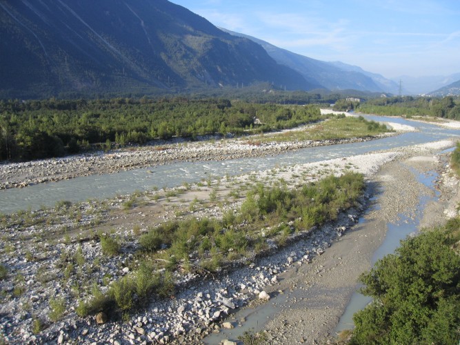
The main valley in the Valais widens, sun warms the dry mountain slopes. Between Leuk and Sierre an unruly part of the Rhone, and the Pfynwald, a nature reserve on a huge mound of glacier detritus; a motorway will be built here.
Between Susten and Sierre lies the Pfynwald, the heart of the Pfyn-Finges Nature Park. A huge pine forest occupies the valley floor through which the wild Rhone flows. The park stretches from the vineyards to the summit of the Weisshorn (4500 m).
Season
All season
Route-information
- Length
- 42.00 km
- Altitude difference ascent
- 120 m
- Altitude difference descent
- 260 m
- Level technique
- Middle
- Level condition
- Middle
Arrival
- Starting point
- Brig / Naters (Altitude: 673 m)
- Arrival by public transport
- Brig, Bahnhof Timetable SBB
- Destination
- Sierre (Altitude: 529 m)
- Arrival by public transport
- Sierre/Siders, gare CFF Timetable SBB
The offer is suitable for
- Adults
- 50+