Sunshine Trail - Leukerbad-Albinen-Sämsu-Brentschen-Jeizinen
Hiking trail
Sunshine Trail

Discover unspoilt centuries-old village centres on the sunny mountain:
Leukerbad - Albinen - Sämsu - Brentschen - Engersch - Jeizinen
Distance 17 km
Time required 5 h 15
Altitude difference: Ascent 760 m
Altitude difference: Descent 630 m
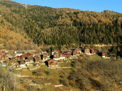
The starting section leads over spectacular ladders, an ancient connecting route, into the sun-tanned village of Albinen with a superb location over the Dala gorge. The original hamlets of Brentschen, Engersch and Jeizinen also lie on the sunny slope and are connected by leisurely hiking trails.
Shortly after Leukerbad the route goes up the Albinen ladders. These are only suitable for persons who aren't afraid of heights. An alternative is to take the footpath through the car tunnel.
Season
All season
Route-information
- Length
- 17.00 km
- Vertical heigth
- 130 m
- Altitude difference ascent
- 760 m
- Altitude difference descent
- 630 m
- Time required
- 4 - 6h
- Level technique
- Middle
- Level condition
- Hard
Arrival
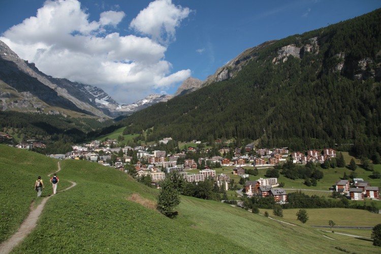
- Starting point
- Leukerbad (Altitude: 1382 m)
- Arrival by public transport
- Leukerbad, Bahnhof Timetable SBB
- Destination
- Jeizinen (Altitude: 1516 m)
- Arrival by public transport
- Jeizinen (Bergstation) Timetable SBB
The offer is suitable for
- Adults
- Children >12 years
- 50+